Google Maps to show toll pricing on select Indian roads - Here are the details
A slew of updates for Apple Watch-users

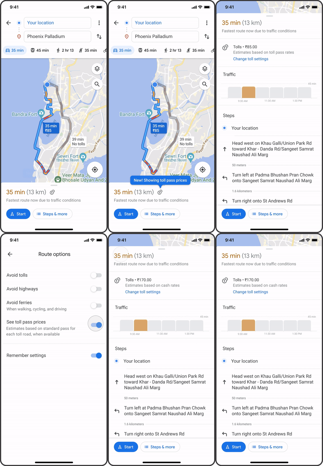
Google Maps is rolling out a clutch of new features, one of which is that it will show estimated toll prices to users' destination even before the trip starts. The feature, rolled out for the first time, will help users to make the choice between toll roads and regular roads easier. This feature, which will be based on 'trusted information from local tolling authorities', is rolling out this month for nearly 2,000 toll roads in India, the US, Japan, and Indonesia.
Other improvements that Google Maps has announced include a more detailed navigation map, and iOS updates to help you plan your drive, save money and explore a new place.
Rich new details

Announcing toll feature, Rubén Lozano-Aguilera Product Manager, Google Maps said, "We look at factors like the cost of using a toll pass or other payment methods, what the day of the week it is, along with how much the toll is expected to cost at the specific time you’ll be crossing it." Google Maps will also show as an option when a toll-free route is available.
Users can also choose to avoid seeing routes with toll roads completely. They just have to tap on the three dots at the top right corner of the directions in Google Maps to see their route options and select ‘Avoid tolls.’
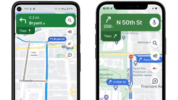
Google Maps is also adding rich new details like traffic lights and stop signs along your route, along with enhanced details like building outlines and areas of interest.
And, in select cities, it will show even more detailed information, like the shape and width of a road, including medians and islands so that users can better understand where they are, and help decrease the odds of making last-minute lane changes or missing a turn.
The new navigation map starts rolling out to select countries in the coming weeks on Android, iOS, Android Auto and CarPlay.
Get daily insight, inspiration and deals in your inbox
Sign up for breaking news, reviews, opinion, top tech deals, and more.
Navigation made easier through Apple Watch

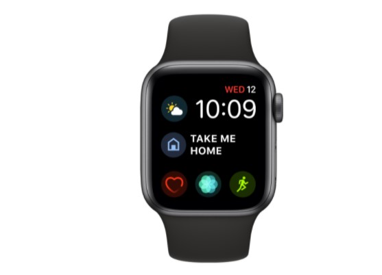
Further, Google has also released new updates for iOS users to make Google Maps easier to use on an Apple Watch. "Starting in a few weeks, you’ll no longer need to begin navigation from your iPhone. Simply tap on the Google Maps shortcut in your Apple Watch app, and the navigation will start automatically on your Apple Watch. You can also add the 'Take me home' complication to your watch and tap it to start the navigation home on Google Maps." A complication is a timely, relevant information on the watch face, where people can view it every time they raise their wrist.
The new updates include a new pinned trip widget, direct navigation from the Apple Watch, and Google Maps integration into Siri and the shortcuts app. Also, iOS users can check out the arrival time, the next departure for the chosen public transport trip, and even a suggested route for those looking to drive, directly from the new pinned trip widget.
Google Maps also announced integration into iOS Spotlight, Siri, and the Shortcuts app. You can just say “Hey Siri, get directions” or “Hey Siri, search in Google Maps” to access Google Maps’ helpful information instantly. This feature will be available in the coming months, with enhanced Siri search functionality coming later this summer.

Over three decades as a journalist covering current affairs, politics, sports and now technology. Former Editor of News Today, writer of humour columns across publications and a hardcore cricket and cinema enthusiast. He writes about technology trends and suggest movies and shows to watch on OTT platforms.