Google Maps update will help you breathe a little easier
Google Maps now shows air quality and wildfire information

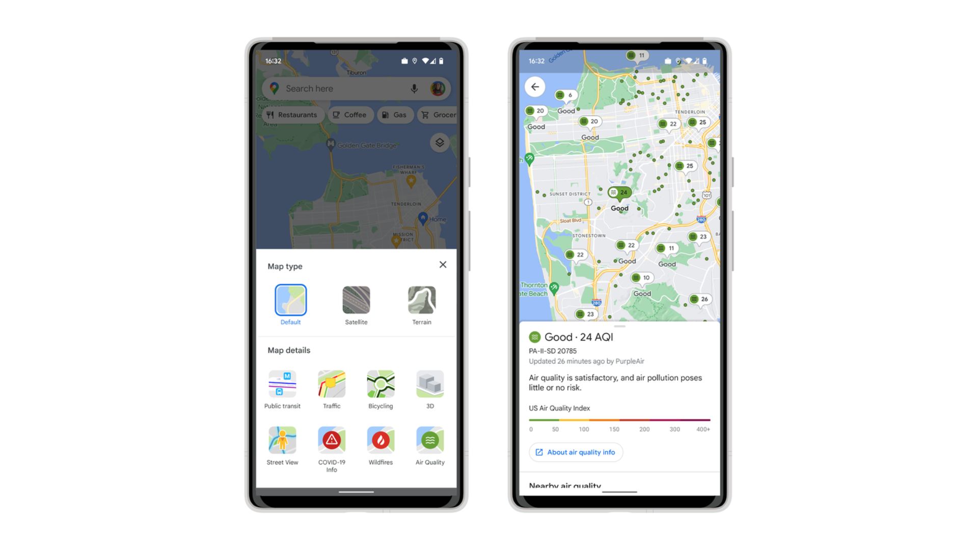
Google Maps has a new update for iPhone and Android smartphone users that will make it safer to explore the outdoors this summer. When using the app on your phone you’ll now have the option to see your local area’s Air Quality Index, alongside guidance on what is safe (or isn’t safe) to do outside.
The data is collected from government agencies such as the Environmental Protection Agency in the US and PurpleAir – a network of privately owned air-quality sensors, data from which is pooled to create a publicly available map of air quality on a more local level.
To access this new air quality info, all you have to do is open the Google Maps app, tap the layers icon (it’s the stack of squares under the search bar in the top-right corner) and select Air quality at the bottom-right.
Right now data is only available for parts of the US, Australia and India, but we expect support for other regions will be added over time. Those of you in the US will also be able to access local PurpleAir information on your Google Nest speakers and Google Nest hub displays.

Google Maps is heating up
Beyond air quality, Google will also be adding active wildfire data to its Maps services.
Right next to the Air Quality layer in Google Maps is the Wildfires layer. Turning this on will give you details about nearby active fires, using data from the National Interagency Fire Center in the US as well as agencies in other regions.
You can also use Google Search to look up 'wildfires near me' to see information about local fires, including air quality and current safety guidance. Google eventually hopes to add smoke data from the National Oceanic and Atmospheric Administration to further improve its services in the US.
Get daily insight, inspiration and deals in your inbox
Sign up for breaking news, reviews, opinion, top tech deals, and more.
Much like the air quality feature, Google's wildfire data isn’t yet as comprehensive as it could be, so remember to take necessary precautions when exploring the outdoors, and follow the most up-to-date local guidance about avoiding certain areas.
If you're looking for more Google Maps tips then check out this guide for how to save money on gas using the service, or this guide for five things you didn't know Google Maps could do.

Hamish is a Senior Staff Writer for TechRadar and you’ll see his name appearing on articles across nearly every topic on the site from smart home deals to speaker reviews to graphics card news and everything in between. He uses his broad range of knowledge to help explain the latest gadgets and if they’re a must-buy or a fad fueled by hype. Though his specialty is writing about everything going on in the world of virtual reality and augmented reality.