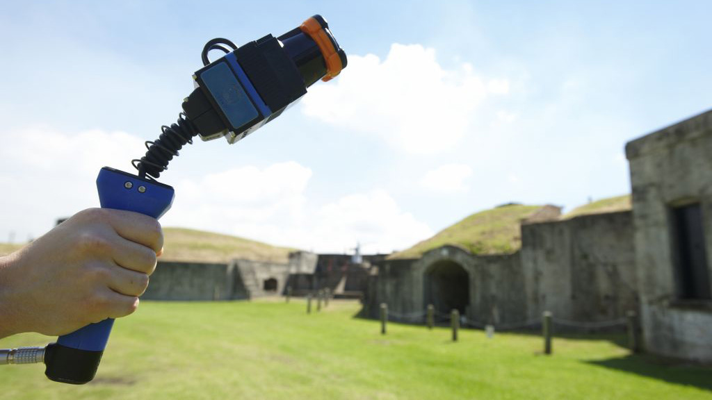
CSIRO shooting heritage sites with lasers (to digitally map them)
New handheld laser mapping technology helping to map 3D objects quickly and easily

Australia's Commonwealth Scientific and Industrial Research Organisation (CSIRO) has joined forces with the University of Queensland to deploy scientists with handheld lasers.
But instead of using laser technology for evil, CSIRO is planning on using the handheld lasers - dubbed Zebedee - to create accurate 3D maps of heritage sites around Australia.
The laser, mounted on a spring, swings back and forth as a scientist carries it, collecting millions of data points and mapping an environment in 3D by simply walking through it.
With the spring calibrated, it converts the natural movements of the walker into a sweeping gesture to ensure a widely scanned field of view.
Frickin' scientists with frickin' laser beams
The practical application of the technology is in allowing researchers to quickly and accurately map a 3D environment. This is especially useful for fragile or awkwardly located sites.
Professor John Macarthur from the University of Queensland, explained that the technology offers a lot of cost and time saving opportunities over traditional heritage monitoring.
""We're looking to use these maps in the future to create an archive of rich data about cultural heritage sites, which will allow us to analyse them without costly and time consuming hand measuring. From this, we have already analysed important aspects of Australian history.
Get daily insight, inspiration and deals in your inbox
Sign up for breaking news, reviews, opinion, top tech deals, and more.
"For example, the detailed map of Peel Island's many small buildings allowed us to analyse architecture used to racially segregate people within the leper colony. The point cloud data clearly depicts how cramped and crowded the living quarters for Indigenous people were, when compared to the non-Indigenous people who lived in their own huts with scenic verandas," he said.