Beyond beacons: The cool 'lighthouse' tech that will map the indoors
From Radio Dots and 3D sensors to machine vision and location by LED
Geomagnetic positioning
Relying on sensor fusion does away with the need for expensive infrastructure, such as Bluetooth beacons and Radio Dots, but IndoorAtlas has something way more interesting than Wi-Fi. Using the compass already inside any smartphone, its tech detects anomalies in the Earth's magnetic field and pinpoints then tracks a person's location indoors to an accuracy of two metres. In terms of the booming 'high accuracy location tech', it's this innovative technique that has people most excited.
Machine vision
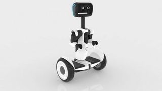
Any discussion of indoor location tech has to include machine vision; the tech that allows robots to 'see'. Also called 'industrial vision', it's a system of cameras, image and text recognition software. Why do we need robots in malls, airports and colleges? We probably don't – think machinery that can move around a factory, accurately inspect equipment for faults, read barcodes, and count far, far quicker than humans.
Visible Light Communication (VLC)
Flashing lights across the high seas to communicate in Morse code between naval ships was all the rage in the nineteenth century, but it's the same concept behind Visible Light Communication (VLC), only faster.
Using LEDs that flicker ever so slightly – and completely invisibly to the human eye – researchers have worked out how to transmit data via light. Disney Research has been showing off its VLC technology and suggests that it could be a critical tech for the IoT since the infrastructure – LED lighting – is already in place.
Meanwhile Qualcomm Atheros has its Qualcomm Lumicast technology, which brings indoor positioning capabilities – data signals are sent from LED lights and decoded by cameras on smartphones, creating indoor positioning that's claimed to be accurate to as little as a centimetre.

3D sensors and Project Tango
We know that Google and Apple have faced off in the world of beacons, and even that Apple last year quietly released its Indoor Survey app, but it's the search engine billionaires that have the big one; Project Tango.
Google wants to make devices whose cameras are part of a personal, real-time 3D mapping system that makes 250,000 measurements per second. With a human-like understanding of space and motion, Project Tango – born in the company's Advanced Technology and Projects (ATAP) division – is about doing more with the surrounding environment.
Are you a pro? Subscribe to our newsletter
Sign up to the TechRadar Pro newsletter to get all the top news, opinion, features and guidance your business needs to succeed!
Never getting lost is the basic premise – unlike Google Maps or any kind of GPS system, which relies on exterior hardware and infrastructure, a Project Tango device continually tracks its own full 3D motion, simultaneously creating and recording a map of the environment.
The key advance here is 3D sensors, with tiny 3D camera modules for smartphones set to bring significant improvements in mapping and location accuracy.
Whatever technology becomes prevalent, and when, it now looks almost certain that no-one or no thing will ever get lost again.
- Also check out: Apple vs Google: The battle of the beacons
Jamie is a freelance tech, travel and space journalist based in the UK. He’s been writing regularly for Techradar since it was launched in 2008 and also writes regularly for Forbes, The Telegraph, the South China Morning Post, Sky & Telescope and the Sky At Night magazine as well as other Future titles T3, Digital Camera World, All About Space and Space.com. He also edits two of his own websites, TravGear.com and WhenIsTheNextEclipse.com that reflect his obsession with travel gear and solar eclipse travel. He is the author of A Stargazing Program For Beginners (Springer, 2015),

